Oxfordshire residents can now track real-time traffic

It is Wednesday morning at 9:15. Did you know that a journey on the Iffley Road in Oxfordshire, this morning, will be fastest on a bike? Don’t worry if it is raining, the second fastest option is the bus. Thanks to the Oxbike website this information is available to everyone.
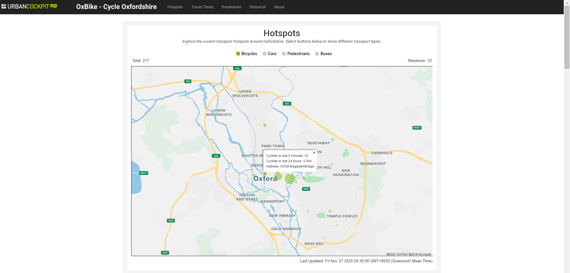
It started with the questions about traffic hotspots and cycling choices. Now Oxfordshire’s cyclists, pedestrians, motorists and bus users can all view real time journeys around local streets thanks to the Oxbike website. It is an output from the Smart Cycle Detection project, which looks to deploy new technology to better provide insight into planning policy and accurate cycling and walking data for users.
Oxbike.co.uk displays live maps that show the number of cyclists and other road users at cycling hotspots in the city. People can also check live travel times on some of Oxford’s key routes and the current and historic trends of vehicle numbers on Oxfordshire’s streets. The website uses real time data collected for Oxfordshire County Council and its partners to 'unlock the potential of emerging smart city technology'.
The information is collected by Vivacity Labs using 24/7 artificial intelligence sensors installed at 60 cycling hotspots in and around the city.
By presenting this data, Oxfordshire County Council seeks to share and open information about cyclists in Oxford. The goal in sharing this live data is to demonstrate how easy it is to get across Oxford by cycling. Data generated from this system is also used to develop cycling and walking strategy and policy, understand how COVID-19 restrictions have affected use of public space and to support teams to secure additional funding for active travel infrastructure.
Oxbike.co.uk is created by [ui!]uk on behalf of Oxfordshire County Council. Bringing all the data together and making it compelling visually was our job. [ui!]uk are dedicated to improving the urban fabric and community well-being through data and shared mobility projects designed to reduce environmental impacts and improve air quality from traffic by using city data, introducing shared electric vehicles and micro-mobility solutions and supporting cities to zero emissions by switching fleets from fossil fuel to electric.
Cllr Yvonne Constance, Oxfordshire County Council’s Cabinet member for environment said:
“Oxbike is a welcome contribution to our travel and transport work as a county and will enable the council and partners to better understand journey data. This will play a particularly important role as the council looks to expand and develop an upgraded cycling infrastructure amid the recovery from the pandemic and as we look to implement ways to cut emissions and wider transport plans including bus gates for Oxford.”
Llewelyn Morgan, Head of Innovation at Oxfordshire County Council said:
“There has been a lot of expectation of the benefit of connected vehicles, which are now becoming prevalent on our roads. Oxfordshire is committed to be at the forefront of this through enabling applications that benefit our communities. This project will develop an important application by connecting data with smart infrastructure to help improve our knowledge of road use and safety on the road for all users.”